
One More Way AI Can Help Us Harness One Of The Most Underutilized Datasets In The World
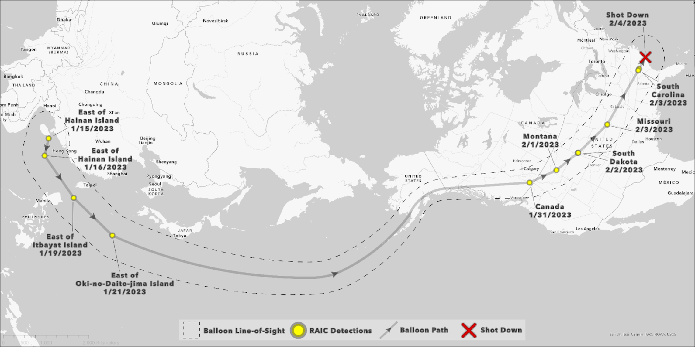
Kevin Weil, the President of Product & Business at Planet, who used the company’s daily satellite imagery to help identify the path of last month’s Chinese high-altitude balloon, discusses how AI aided in its detection. Weil utilized Synthetaic’s Rapid Automated Image Categorization (RAIC) AI tool to find the balloon in the vast satellite data. RAIC eliminated the need for labeled data or pre-existing trained models, and allowed him to find the balloon, something in the data that had never been found before.
Using a rough hand drawing of what he expected the balloon to look like in the satellite imagery, RAIC provided Weil with a positive match within two minutes. This human-machine collaboration allowed for the sifting through of terabytes of data in mere minutes. Using open-source intelligence, and wind forecasts, the team had tracked the balloon’s entry into the US, in Spokane, Washington, and eventually all the way back to the South China sea. Weil goes on to state, ‘RAIC fundamentally changes what’s possible with AI.’